How to start
Match the workflow first
What is still in development we will not describe as ready. Tell us what you need to do; we will say whether we cover it now.
Trial or a pilot
If a pilot fits, we install it. If it does not, we say so — we do not force a sale.
Buy after it ships
Prices are on the pricing page. We will not put a placeholder number for something not priced yet.
What it solves
Format barriers in spatial data are a real cost. A GPKG has to become MBTiles, a Shapefile has to go into a new system, and each time someone has to write a conversion script. Scripts sit on people's machines, nobody remembers the parameters, and when something fails you cannot tell which step went wrong. Worse, this data is often classified and cannot be uploaded to an online converter. Yuhox Geo turns common spatial-format conversion into a desktop app: it runs locally, uploads nothing, and never goes online.
Before and now
| Before | Now |
|---|---|
| Every conversion means finding someone to write a script, with parameters held in memory | Pick a format, set parameters, and run the job in the desktop app; the process can be reviewed |
| Online converters work, but you do not want to send the data | Runs entirely locally; data never leaves this machine |
| Piles of A-to-B scripts, and pairwise adapters never end | A unified data model underneath. Adding a format means writing only the read/write between it and the model. |
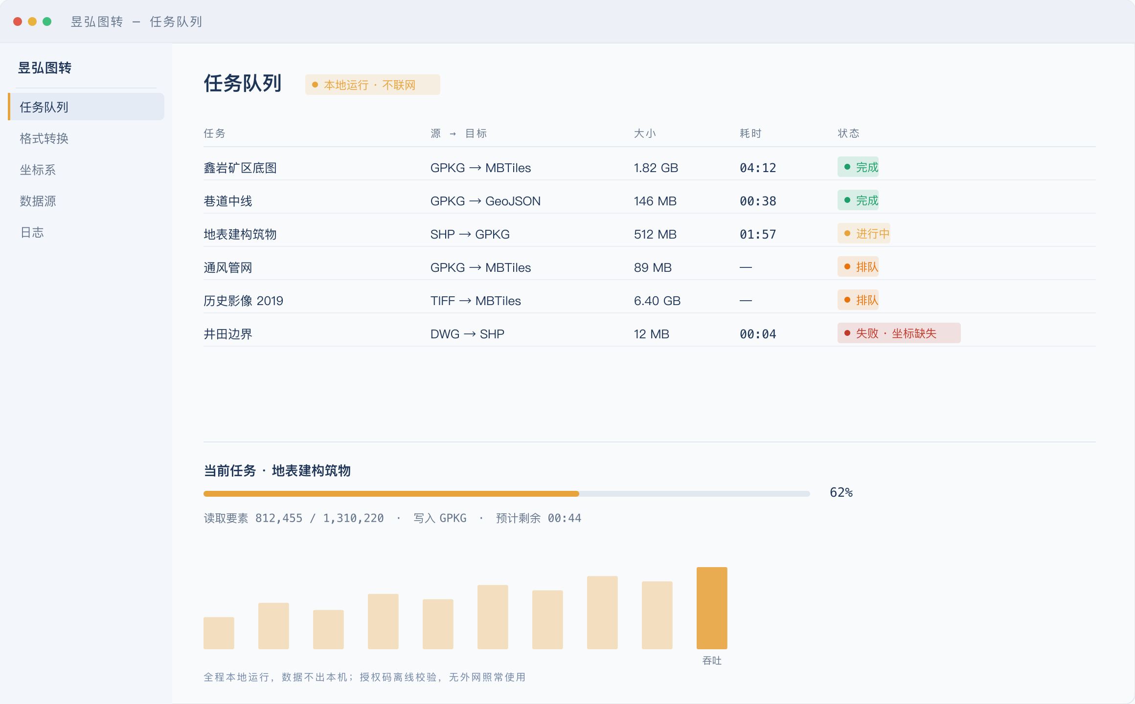
| Large conversions have to be watched; a mid-run failure means starting over | Jobs run in a queue. Status, time taken, and failure reason stay in the queue |
| Installed on a classified intranet, so the license cannot be activated online | License codes verify offline; works as usual with no internet |
Core capabilities
- 01
Any-to-any conversion
Convert common vector and tile formats both ways, on a unified data model, not one-to-one hard-coded scripts.
- 02
Runs locally
Desktop software; data never leaves the machine. Spatial data is often confidential — that's a hard requirement.
- 03
Job queue
转换任务排队执行,状态、耗时、失败原因都留在队列里,大数据量不必守着。
- 04
坐标系一起转
中国工程常用坐标系按预设给出,也能从坐标数值反推带号。源与目标各选一次,投影在读写之间做掉。
- 05
先体检再转换
打开数据先出画像:几何问题、坐标系是否对得上、建议出成什么格式、瓦片出到几级。
- 06
流式读写
百万级要素不进内存,游标一行行走,不会因为表大而打不开。
- 07
Offline licensing
授权码离线校验,无外网环境照常使用。不装授权也能干活,只是单线程、瓦片级别与单次要素数有上限。
Who it is for
Surveying, land and planning agencies
The data is classified, so online tools are out, but you still have to convert formats often
Integrators working on GIS projects
Every new system means converting the data again. That should stop taking a person
Teams that maintain their own base maps
Basemap updates need tiles; you want the process fixed so it is not done by hand every time
Why this one
Unified data model
No one-to-one conversion scripts. Every format goes into a unified model first, then out of the model to the target format. The cost of adding a format is linear, not quadratic.
Local is a hard requirement
Classified spatial data is the norm. A desktop app and offline licensing are not about saving on servers. The data is not allowed to leave.
Process trail
The job queue records parameters, time taken, and result for every conversion. When something fails you can trace the exact step, not just run it again and see.
坐标系一起处理
中国工程常用坐标系按预设给出,也能从坐标数值本身反推带号。源与目标各选各的,投影在读写之间一次做掉,不必再拿别的软件补一遍。
转之前先给数据做个体检
打开一份数据先出画像:几何有什么问题、坐标系对不对得上、建议出成什么格式、瓦片出到几级、有哪些风险。拿到别人的数据不敢直接用时,这一步比转换本身更省事。
百万级要素不进内存
读写都是流式的,打开与转换不吃整表内存,队列可以慢慢排。
Same job, two ways
The left column is how most sites work today — no vendor names. The right column is whatever version you actually receive.
| Topic | Common practice | Yuhox Geo |
|---|---|---|
| How to convert | Someone writes a script each time; parameters live in memory | Pick formats, set parameters, run a job in a desktop app. The run is replayable |
| Can the data leave the building | Online converters work, but classified data cannot go there | Runs entirely on the machine. Data never leaves it |
| More formats every year | A-to-B scripts grow by the square of the format count | One data model. A new format only needs read/write against that model |
| How to activate on an intranet | It only works online | License codes verify offline; works as usual with no internet |
| 坐标系 | 转完再拿别的软件投影一遍,参数靠问 | 源与目标各选一次,投影在转换里做掉 |
| 拿到不确定的数据 | 先转一版看看,错了再回头 | 先出数据画像与风险提示,再决定出成什么 |
Key parameters
| Form | Wails desktop app, single executable |
|---|---|
| Platform | Windows 10+ / macOS 12+ |
| Core | Unified data model + task queue |
| Licenses | Ed25519 signature, offline verification |
| Free edition | 单线程、瓦片到 14 级、单次转换一万个要素,不联网、永不过期 |
| Pro | 放开线程与瓦片级别,含批量与命令行,按年授权 |
| Network | No internet needed at any point |
Up front
Which formats are supported?
读入这边已经打通 Shapefile、GPKG、GeoJSON、DXF、DWG、KML、KMZ、File GDB、GML、DGN,以及 GeoTIFF、DEM 和 PNG/JPEG 栅格;写出这边已经打通 GPKG、Shapefile、GeoJSON、MBTiles、XYZ 与 MVT 瓦片。这些都带自动化测试。还没发布的格式我们不当成现成的说。
Is there a command-line version?
命令行与批量转换在规划的专业版里,做出来之后可以嵌进你们已有的自动化流程。当前这一版是界面里跑任务。
How large a dataset can it handle?
Limited by this machine's RAM and disk. For large jobs, 16 GB RAM or more is recommended. The job queue can wait in line; you do not have to load everything at once.
Tell us what you need to convert
Tell us the source format, target format and data volume. We will judge whether the current version covers it and when it will.